
Keyword
Earth Science | Atmosphere | Atmospheric Winds | Surface Winds | Wind Speed/Wind Direction
153 record(s)
Type of resources
Topics
Keywords
Contact for the resource
Provided by
Formats
Update frequencies
Status
draft
-
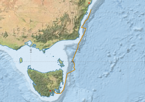
This record describes the Underway (UWY) data collected from the Marine National Facility (MNF) RV Investigator Voyage IN2016_E02, titled: "MNF Equipment Sea Trials." The voyage took place between December 15 and December 19, 2016 departing from Sydney (NSW) and arriving in Hobart (TAS). Standard Underway data is continuously recorded, consisting of: (1) Navigation data (NAV): Latitude, Longitude, Speed, Heading, Course Over Ground, Gyros, and Doppler Log (dual GPS instrument). (2) Thermosalinograph (TSG): Water Salinity, Flow-Rate, Temperature, Fluorescence, pCO2 and Optode/Oxygen. (3) Atmospheric (MET): Humidity, Wind Speed and Direction (vane and ultrasonic), Radiometer/Sea Surface Temprature, Pyranometer/Solar Radiation, Photosynthetically Active Radiation (PAR), Air Temperature, Air Pressure, Rain, Ozone and Trace Gases (port and starboard instruments). Data are recorded at 5 second intervals. Near real-time data are available via the link "Visualisation tool for Underway Data." This dataset will be processed and archived within the CSIRO Oceans & Atmosphere (O&A) Information and Data Centre (IDC) in Hobart (TAS). Data are available at time intervals of 5 sec (NetCDF format), 10 sec and 5 min (ASCII format). Additional information regarding this dataset is contained in the Cruise Summary Report and/or the Data Processing Report for this voyage.
-
This record describes the Underway (UWY) data collected from the Marine National Facility (MNF) RV Investigator Voyage IN2016_V04, titled: "Influence of temperature and nutrient supply on the biogeochemical function and diversity of ocean microbes." The voyage took place between August 31 and September 22, 2016 departing from Sydney(NSW) and arriving in Brisbane (QLD). Standard Underway data is continuously recorded, consisting of: (1) Navigation data (NAV): Latitude, Longitude, Speed, Heading, Course Over Ground, Gyros, and Doppler Log (dual GPS instrument). (2) Thermosalinograph (TSG): Water Salinity, Flow-Rate, Temperature, Fluorescence, pCO2 and Optode/Oxygen. (3) Atmospheric (MET): Humidity, Wind Speed and Direction (vane and ultrasonic), Radiometer/Sea Surface Temprature, Pyranometer/Solar Radiation, Photosynthetically Active Radiation (PAR), Air Temperature, Air Pressure, Rain, Ozone and Trace Gases (port and starboard instruments). Data are recorded at 5 second intervals. Near real-time data is available via the link "Visualisation yool for Underway Data." This dataset will be processed and archived within the CSIRO Oceans & Atmosphere (O&A) Information and Data Centre (IDC) in Hobart. Data is available at time intervals of 5sec (NetCDF format), 10 sec and 5 min (ASCII format). Additional information regarding this dataset is contained in the Cruise Summary Report and/or the Data Processing Report for this voyage.
-
This record describes the Underway (UWY) data collected from the Marine National Facility (MNF) RV Investigator Voyage IN2017_E04, titled: "Sea Trials, Calibration & Training." The voyage took place between December 7 and December 12, 2017 departing from Hobart (TAS) and arriving in Hobart. Standard Underway data is continuously recorded, consisting of: (1) Navigation data (NAV): Latitude, Longitude, Speed, Heading, Course Over Ground, Gyros, and Doppler Log (dual GPS instrument). (2) Thermosalinograph (TSG): Water Salinity, Flow-Rate, Temperature, Fluorescence, pCO2 and Optode/Oxygen. (3) Atmospheric (MET): Humidity, Wind Speed and Direction (vane and ultrasonic), Radiometer/Sea Surface Temprature, Pyranometer/Solar Radiation, Photosynthetically Active Radiation (PAR), Air Temperature, Air Pressure, Rain, Ozone and Trace Gases (port and starboard instruments). The quality-controlled RV Investigator underway meteorological and SST data are supplied to the IMOS AODN where they are publicly available at the "Ships of Opportunity" Thredds server (http://thredds.aodn.org.au/thredds/catalog/IMOS/SOOP/SOOP-ASF/VLMJ_Investigator/catalog.html) for research. From there, they are downloaded by NOAA for their In Situ Quality Monitoring web site (iQUAM2) and made available for satellite SST validation. The SBE 38 SST data are used within the Australian Bureau of Meteorology for real-time satellite SST validation and ingested into real-time SST analyses which are then used as the boundary condition for Numerical Weather Prediction models. The meteorological and SST data are uploaded onto the Global Telecommunications System (GTS) for global dissemination to Meteorological Agencies, and separately supplied to the SAMOS (http://samos.coaps.fsu.edu/html/) Project for air-sea flux research. The real-time SBE 38 SST data are currently (2017) used in the following data products (accessed via the GTS): • International Comprehensive Ocean-Atmosphere Data Set (ICOADS R3.0) (http://icoads.noaa.gov/) • NOAA NCEI Extended Reconstructed Sea Surface Temperature version 4 (ERSST.v4) (https://www.ncdc.noaa.gov/data-access/marineocean-data/extended-reconstructed-sea-surface-temperature-ersst-v4) • Hadley Centre SST Data Set (HadSST3) (http://www.metoffice.gov.uk/hadobs/hadsst3/) • Global Ocean Surface Underway Data (GOSUD) Project (http://www.gosud.org/) • Bureau of Meteorology daily and weekly SST analyses (http://www.bom.gov.au/marine/sst.shtml) • NOAA NCEI “Reynolds” daily global OISST analysis (https://www.ncdc.noaa.gov/oisst) • NASA JPL “MUR” 1 km daily global SST analysis (https://mur.jpl.nasa.gov/) • UK Met Office “OSTIA” daily global SST analysis (http://ghrsst-pp.metoffice.com/pages/latest_analysis/ostia.html) • CMC daily global SST analysis • Ourocean “G1SST” global daily 1 km SST analysis (https://ourocean.jpl.nasa.gov/SST) As part of the underway data gathering system, other datasets are produced (e.g., pCO2, ISAR SST) which are processed separately and have their own metadata records. Data are recorded at 5 second intervals. Near real-time data are available via the link "Visualisation tool for Underway Data." This dataset will be processed and archived within the CSIRO Oceans & Atmosphere (O&A) Information and Data Centre (IDC) in Hobart (TAS). Data are available at time intervals of 5 sec (NetCDF format), 10 sec and 5 min (ASCII format). Additional information regarding this dataset is contained in the Voyage Summary and/or the Data Processing Report for this voyage.
-
This record describes the Underway (UWY) data collected from the Marine National Facility (MNF) RV Investigator Voyage IN2017_E03, titled: "Brisbane Port Period Sea Trials." The voyage took place between August 20 and August 23, 2017 departing from Brisbane (QLD) and arriving in Brisbane. Standard Underway data is continuously recorded, consisting of: (1) Navigation data (NAV): Latitude, Longitude, Speed, Heading, Course Over Ground, Gyros, and Doppler Log (dual GPS instrument). (2) Thermosalinograph (TSG): Water Salinity, Flow-Rate, Temperature, Fluorescence, pCO2 and Optode/Oxygen. (3) Atmospheric (MET): Humidity, Wind Speed and Direction (vane and ultrasonic), Radiometer/Sea Surface Temprature, Pyranometer/Solar Radiation, Photosynthetically Active Radiation (PAR), Air Temperature, Air Pressure, Rain, Ozone and Trace Gases (port and starboard instruments). The quality-controlled RV Investigator underway meteorological and SST data are supplied to the IMOS AODN where they are publicly available at the "Ships of Opportunity" Thredds server (http://thredds.aodn.org.au/thredds/catalog/IMOS/SOOP/SOOP-ASF/VLMJ_Investigator/catalog.html) for research. From there, they are downloaded by NOAA for their In Situ Quality Monitoring web site (iQUAM2) and made available for satellite SST validation. The SBE 38 SST data are used within the Australian Bureau of Meteorology for real-time satellite SST validation and ingested into real-time SST analyses which are then used as the boundary condition for Numerical Weather Prediction models. The meteorological and SST data are uploaded onto the Global Telecommunications System (GTS) for global dissemination to Meteorological Agencies, and separately supplied to the SAMOS (http://samos.coaps.fsu.edu/html/) Project for air-sea flux research. The real-time SBE 38 SST data are currently (2017) used in the following data products (accessed via the GTS): • International Comprehensive Ocean-Atmosphere Data Set (ICOADS R3.0) (http://icoads.noaa.gov/) • NOAA NCEI Extended Reconstructed Sea Surface Temperature version 4 (ERSST.v4) (https://www.ncdc.noaa.gov/data-access/marineocean-data/extended-reconstructed-sea-surface-temperature-ersst-v4) • Hadley Centre SST Data Set (HadSST3) (http://www.metoffice.gov.uk/hadobs/hadsst3/) • Global Ocean Surface Underway Data (GOSUD) Project (http://www.gosud.org/) • Bureau of Meteorology daily and weekly SST analyses (http://www.bom.gov.au/marine/sst.shtml) • NOAA NCEI “Reynolds” daily global OISST analysis (https://www.ncdc.noaa.gov/oisst) • NASA JPL “MUR” 1 km daily global SST analysis (https://mur.jpl.nasa.gov/) • UK Met Office “OSTIA” daily global SST analysis (http://ghrsst-pp.metoffice.com/pages/latest_analysis/ostia.html) • CMC daily global SST analysis • Ourocean “G1SST” global daily 1 km SST analysis (https://ourocean.jpl.nasa.gov/SST) As part of the underway data gathering system, other datasets are produced (e.g., pCO2, ISAR SST) which are processed separately and have their own metadata records. Data are recorded at 5 second intervals. Near real-time data are available via the link "Visualisation tool for Underway Data." This dataset will be processed and archived within the CSIRO Oceans & Atmosphere (O&A) Information and Data Centre (IDC) in Hobart (TAS). Data are available at time intervals of 5 sec (NetCDF format), 10 sec and 5 min (ASCII format). Additional information regarding this dataset is contained in the Voyage Summary and/or the Data Processing Report for this voyage.
-
This record describes the Underway (UWY) data collected from the Marine National Facility (MNF) RV Investigator Voyage IN2017_V04, titled: "The whole enchilada: from production to predation in Tasman Sea ecosystems." The voyage took place from Brisbane (QLD) to Sydney (NSW) between August 31 and September 18, 2017. Standard Underway data is continuously recorded, consisting of: (1) Navigation data (NAV): Latitude, Longitude, Speed, Heading, Course Over Ground, Gyros, and Doppler Log (dual GPS instrument). (2) Thermosalinograph (TSG): Water Salinity, Flow-Rate, Temperature, Fluorescence, pCO2, Optode temperature and Oxygen. (3) Atmospheric (MET): Humidity, Wind Speed and Direction (vane and ultrasonic), Radiometer/Sea Surface Temperature, Pyranometer/Solar Radiation, Photosynthetically Active Radiation (PAR), Air Temperature, Air Pressure, Rain, Ozone and Trace Gases (port and starboard instruments). Data are recorded at 5 second intervals. Near real-time data are available via the link "Visualisation tool for Underway Data." This dataset has been processed and archived within the CSIRO Oceans & Atmosphere (O&A) Information and Data Centre (IDC) in Hobart (TAS). Data are available at time intervals of 5 sec (NetCDF format), 10 sec and 5 min (csv format). Additional information regarding this dataset is contained in the Voyage Summary and/or the Data Processing Report for this voyage.
-
This record describes the Underway (UWY) data collected from the Marine National Facility (MNF) RV Investigator Voyage IN2017_V05, titled: "Long-term recovery of trawled marine communities 25 years after the world’s largest adaptive management experiment." The voyage took place between October 11 and November 10, 2017 departing from Broome (WA) and arriving in Fremantle (WA). Standard Underway data is continuously recorded, consisting of: (1) Navigation data (NAV): Latitude, Longitude, Speed, Heading, Course Over Ground, Gyros, and Doppler Log (dual GPS instrument). (2) Thermosalinograph (TSG): Water Salinity, Flow-Rate, Temperature, Fluorescence, pCO2, Optode temperature and Oxygen. (3) Atmospheric (MET): Humidity, Wind Speed and Direction (vane and ultrasonic), Radiometer/Sea Surface Temperature, Pyranometer/Solar Radiation, Photosynthetically Active Radiation (PAR), Air Temperature, Air Pressure, Rain, Ozone and Trace Gases (port and starboard instruments). Data are recorded at 5 second intervals. Near real-time data are available via the link "Visualisation tool for Underway Data." This dataset has been processed and archived within the CSIRO Oceans & Atmosphere (O&A) Information and Data Centre (IDC) in Hobart (TAS). Data are available at time intervals of 5 sec (NetCDF format), 10 sec and 5 min (csv format). Additional information regarding this dataset is contained in the Voyage Summary and/or the Data Processing Report for this voyage.
-
This record describes the Underway (UWY) data collected from the Marine National Facility (MNF) RV Investigator Voyage IN2018_E03, titled: "Gear trials." The voyage took place between December 22 and December 23, 2018 departing from Hobart (TAS) and arriving in Hobart. This voyage was undertaken to test the beam trawl operation after a fix to the winch control system. Standard Underway data is continuously recorded, consisting of: (1) Navigation data (NAV): Latitude, Longitude, Speed, Heading, Course Over Ground, Gyros, and Doppler Log (dual GPS instrument). (2) Thermosalinograph (TSG): Water Salinity, Flow-Rate, Temperature, Fluorescence, pCO2 and Optode/Oxygen. (3) Atmospheric (MET): Humidity, Wind Speed and Direction (vane and ultrasonic), Radiometer/Sea Surface Temperature, Pyranometer/Solar Radiation, Photosynthetically Active Radiation (PAR), Air Temperature, Air Pressure, Rain, Ozone and Trace Gases (port and starboard instruments). The quality-controlled RV Investigator underway meteorological and SST data are supplied to the IMOS AODN where they are publicly available at the "Ships of Opportunity" Thredds server (http://thredds.aodn.org.au/thredds/catalog/IMOS/SOOP/SOOP-ASF/VLMJ_Investigator/catalog.html) for research. From there, they are downloaded by NOAA for their In Situ Quality Monitoring web site (iQUAM2) and made available for satellite SST validation. The SBE 38 SST data are used within the Australian Bureau of Meteorology for real-time satellite SST validation and ingested into real-time SST analyses which are then used as the boundary condition for Numerical Weather Prediction models. The meteorological and SST data are uploaded onto the Global Telecommunications System (GTS) for global dissemination to Meteorological Agencies, and separately supplied to the SAMOS (http://samos.coaps.fsu.edu/html/) Project for air-sea flux research. The real-time SBE 38 SST data are currently (2017) used in the following data products (accessed via the GTS): • International Comprehensive Ocean-Atmosphere Data Set (ICOADS R3.0) (http://icoads.noaa.gov/) • NOAA NCEI Extended Reconstructed Sea Surface Temperature version 4 (ERSST.v4) (https://www.ncdc.noaa.gov/data-access/marineocean-data/extended-reconstructed-sea-surface-temperature-ersst-v4) • Hadley Centre SST Data Set (HadSST3) (http://www.metoffice.gov.uk/hadobs/hadsst3/) • Global Ocean Surface Underway Data (GOSUD) Project (http://www.gosud.org/) • Bureau of Meteorology daily and weekly SST analyses (http://www.bom.gov.au/marine/sst.shtml) • NOAA NCEI “Reynolds” daily global OISST analysis (https://www.ncdc.noaa.gov/oisst) • NASA JPL “MUR” 1 km daily global SST analysis (https://mur.jpl.nasa.gov/) • UK Met Office “OSTIA” daily global SST analysis (http://ghrsst-pp.metoffice.com/pages/latest_analysis/ostia.html) • CMC daily global SST analysis • Ourocean “G1SST” global daily 1 km SST analysis (https://ourocean.jpl.nasa.gov/SST) As part of the underway data gathering system, other datasets are produced (e.g., pCO2, ISAR SST) which are processed separately and have their own metadata records. Data are recorded at 5 second intervals. Near real-time data are available via the link "Visualisation tool for Underway Data." This dataset will be processed and archived within the CSIRO Oceans & Atmosphere (O&A) Information and Data Centre (IDC) in Hobart (TAS). Data are available at time intervals of 5 sec (NetCDF format), 10 sec and 5 min (ASCII format). Additional information regarding this dataset is contained in the Voyage Summary and/or the Data Processing Report for this voyage.
-
This record describes the Underway (UWY) data collected from the Marine National Facility (MNF) RV Investigator Voyage IN2018_E01, titled: "Triaxus Sea Acceptance Testing & Calibrations Voyage." The voyage took place between June 9 and June 11, 2018 departing from Hobart (TAS) and arriving in Hobart. Standard Underway data is continuously recorded, consisting of: (1) Navigation data (NAV): Latitude, Longitude, Speed, Heading, Course Over Ground, Gyros, and Doppler Log (dual GPS instrument). (2) Thermosalinograph (TSG): Water Salinity, Flow-Rate, Temperature, Fluorescence, pCO2 and Optode/Oxygen. (3) Atmospheric (MET): Humidity, Wind Speed and Direction (vane and ultrasonic), Radiometer/Sea Surface Temprature, Pyranometer/Solar Radiation, Photosynthetically Active Radiation (PAR), Air Temperature, Air Pressure, Rain, Ozone and Trace Gases (port and starboard instruments). The quality-controlled RV Investigator underway meteorological and SST data are supplied to the IMOS AODN where they are publicly available at the "Ships of Opportunity" Thredds server (http://thredds.aodn.org.au/thredds/catalog/IMOS/SOOP/SOOP-ASF/VLMJ_Investigator/catalog.html) for research. From there, they are downloaded by NOAA for their In Situ Quality Monitoring web site (iQUAM2) and made available for satellite SST validation. The SBE 38 SST data are used within the Australian Bureau of Meteorology for real-time satellite SST validation and ingested into real-time SST analyses which are then used as the boundary condition for Numerical Weather Prediction models. The meteorological and SST data are uploaded onto the Global Telecommunications System (GTS) for global dissemination to Meteorological Agencies, and separately supplied to the SAMOS (http://samos.coaps.fsu.edu/html/) Project for air-sea flux research. The real-time SBE 38 SST data are currently (2017) used in the following data products (accessed via the GTS): • International Comprehensive Ocean-Atmosphere Data Set (ICOADS R3.0) (http://icoads.noaa.gov/) • NOAA NCEI Extended Reconstructed Sea Surface Temperature version 4 (ERSST.v4) (https://www.ncdc.noaa.gov/data-access/marineocean-data/extended-reconstructed-sea-surface-temperature-ersst-v4) • Hadley Centre SST Data Set (HadSST3) (http://www.metoffice.gov.uk/hadobs/hadsst3/) • Global Ocean Surface Underway Data (GOSUD) Project (http://www.gosud.org/) • Bureau of Meteorology daily and weekly SST analyses (http://www.bom.gov.au/marine/sst.shtml) • NOAA NCEI “Reynolds” daily global OISST analysis (https://www.ncdc.noaa.gov/oisst) • NASA JPL “MUR” 1 km daily global SST analysis (https://mur.jpl.nasa.gov/) • UK Met Office “OSTIA” daily global SST analysis (http://ghrsst-pp.metoffice.com/pages/latest_analysis/ostia.html) • CMC daily global SST analysis • Ourocean “G1SST” global daily 1 km SST analysis (https://ourocean.jpl.nasa.gov/SST) As part of the underway data gathering system, other datasets are produced (e.g., pCO2, ISAR SST) which are processed separately and have their own metadata records. Data are recorded at 5 second intervals. Near real-time data are available via the link "Visualisation tool for Underway Data." This dataset will be processed and archived within the CSIRO Oceans & Atmosphere (O&A) Information and Data Centre (IDC) in Hobart (TAS). Data are available at time intervals of 5 sec (NetCDF format), 10 sec and 5 min (ASCII format). Additional information regarding this dataset is contained in the Voyage Summary and/or the Data Processing Report for this voyage.
-
This record describes the Underway (UWY) data collected from the Marine National Facility (MNF) RV Investigator Voyage IN2018_E02, titled: "Marine National Facility Equipment Calibration, Sea Trials and Personnel Training ." The voyage took place between September 3 and September 9, 2018 departing from Hobart (TAS) and arriving in Hobart. Standard Underway data is continuously recorded, consisting of: (1) Navigation data (NAV): Latitude, Longitude, Speed, Heading, Course Over Ground, Gyros, and Doppler Log (dual GPS instrument). (2) Thermosalinograph (TSG): Water Salinity, Flow-Rate, Temperature, Fluorescence, pCO2 and Optode/Oxygen. (3) Atmospheric (MET): Humidity, Wind Speed and Direction (vane and ultrasonic), Radiometer/Sea Surface Temprature, Pyranometer/Solar Radiation, Photosynthetically Active Radiation (PAR), Air Temperature, Air Pressure, Rain, Ozone and Trace Gases (port and starboard instruments). The quality-controlled RV Investigator underway meteorological and SST data are supplied to the IMOS AODN where they are publicly available at the "Ships of Opportunity" Thredds server (http://thredds.aodn.org.au/thredds/catalog/IMOS/SOOP/SOOP-ASF/VLMJ_Investigator/catalog.html) for research. From there, they are downloaded by NOAA for their In Situ Quality Monitoring web site (iQUAM2) and made available for satellite SST validation. The SBE 38 SST data are used within the Australian Bureau of Meteorology for real-time satellite SST validation and ingested into real-time SST analyses which are then used as the boundary condition for Numerical Weather Prediction models. The meteorological and SST data are uploaded onto the Global Telecommunications System (GTS) for global dissemination to Meteorological Agencies, and separately supplied to the SAMOS (http://samos.coaps.fsu.edu/html/) Project for air-sea flux research. The real-time SBE 38 SST data are currently (2017) used in the following data products (accessed via the GTS): • International Comprehensive Ocean-Atmosphere Data Set (ICOADS R3.0) (http://icoads.noaa.gov/) • NOAA NCEI Extended Reconstructed Sea Surface Temperature version 4 (ERSST.v4) (https://www.ncdc.noaa.gov/data-access/marineocean-data/extended-reconstructed-sea-surface-temperature-ersst-v4) • Hadley Centre SST Data Set (HadSST3) (http://www.metoffice.gov.uk/hadobs/hadsst3/) • Global Ocean Surface Underway Data (GOSUD) Project (http://www.gosud.org/) • Bureau of Meteorology daily and weekly SST analyses (http://www.bom.gov.au/marine/sst.shtml) • NOAA NCEI “Reynolds” daily global OISST analysis (https://www.ncdc.noaa.gov/oisst) • NASA JPL “MUR” 1 km daily global SST analysis (https://mur.jpl.nasa.gov/) • UK Met Office “OSTIA” daily global SST analysis (http://ghrsst-pp.metoffice.com/pages/latest_analysis/ostia.html) • CMC daily global SST analysis • Ourocean “G1SST” global daily 1 km SST analysis (https://ourocean.jpl.nasa.gov/SST) As part of the underway data gathering system, other datasets are produced (e.g., pCO2, ISAR SST) which are processed separately and have their own metadata records. Data are recorded at 5 second intervals. Near real-time data are available via the link "Visualisation tool for Underway Data." This dataset will be processed and archived within the CSIRO Oceans & Atmosphere (O&A) Information and Data Centre (IDC) in Hobart (TAS). Data are available at time intervals of 5 sec (NetCDF format), 10 sec and 5 min (ASCII format). Additional information regarding this dataset is contained in the Voyage Summary and/or the Data Processing Report for this voyage.
-
This record describes the Underway (UWY) data collected from the Marine National Facility (MNF) RV Investigator Voyage IN2016_T01 titled: Continuity of Australian terranes into Zealandia: towards a geological map of the east Gondwana margin". The voyage took place from Laukota (Fiji) to Hobart (TAS) between June 30 and July 14, 2016. Standard Underway data is continuously recorded, consisting of: (1) Navigation data (NAV): Latitude, Longitude, Speed, Heading, Course Over Ground, Gyros, and Doppler Log (dual GPS instrument). (2) Thermosalinograph (TSG): Salinity, Flow-Rate, Temperature, Fluorescence, pCO2, Optode Temperature and Oxygen. (3) Atmospheric (MET): Humidity, Wind Speed and Direction (vane and ultrasonic), Radiometer/Sea Surface Temperature, Pyranometer/Solar Radiation, Photosynthetically Active Radiation (PAR), Air Temperature, Air Pressure, Rain, Ozone and Trace Gases (port and starboard instruments). Data are recorded at 5 second intervals. Near real-time data is available via the link "Visualisation tool for Underway Data". This dataset has been processed and archived within the CSIRO Oceans & Atmosphere (O&A) Information and Data Centre (IDC) in Hobart. Data is available at time intervals of 5 sec (NetCDF format), 10 sec and 5 min (ASCII format). Additional information regarding this dataset is contained in the Cruise Summary Report and/or the Data Processing Report for this voyage.